Outreach Projects
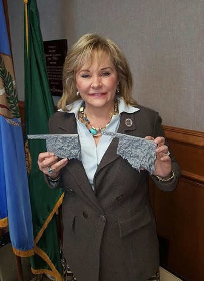
Touch and hold 3D printouts of Oklahoma Rainfall
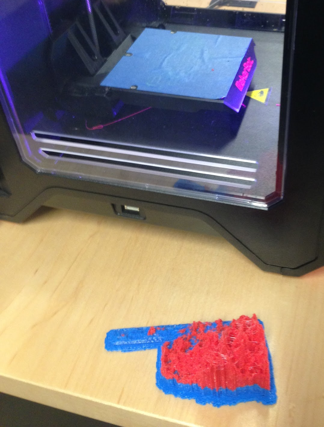
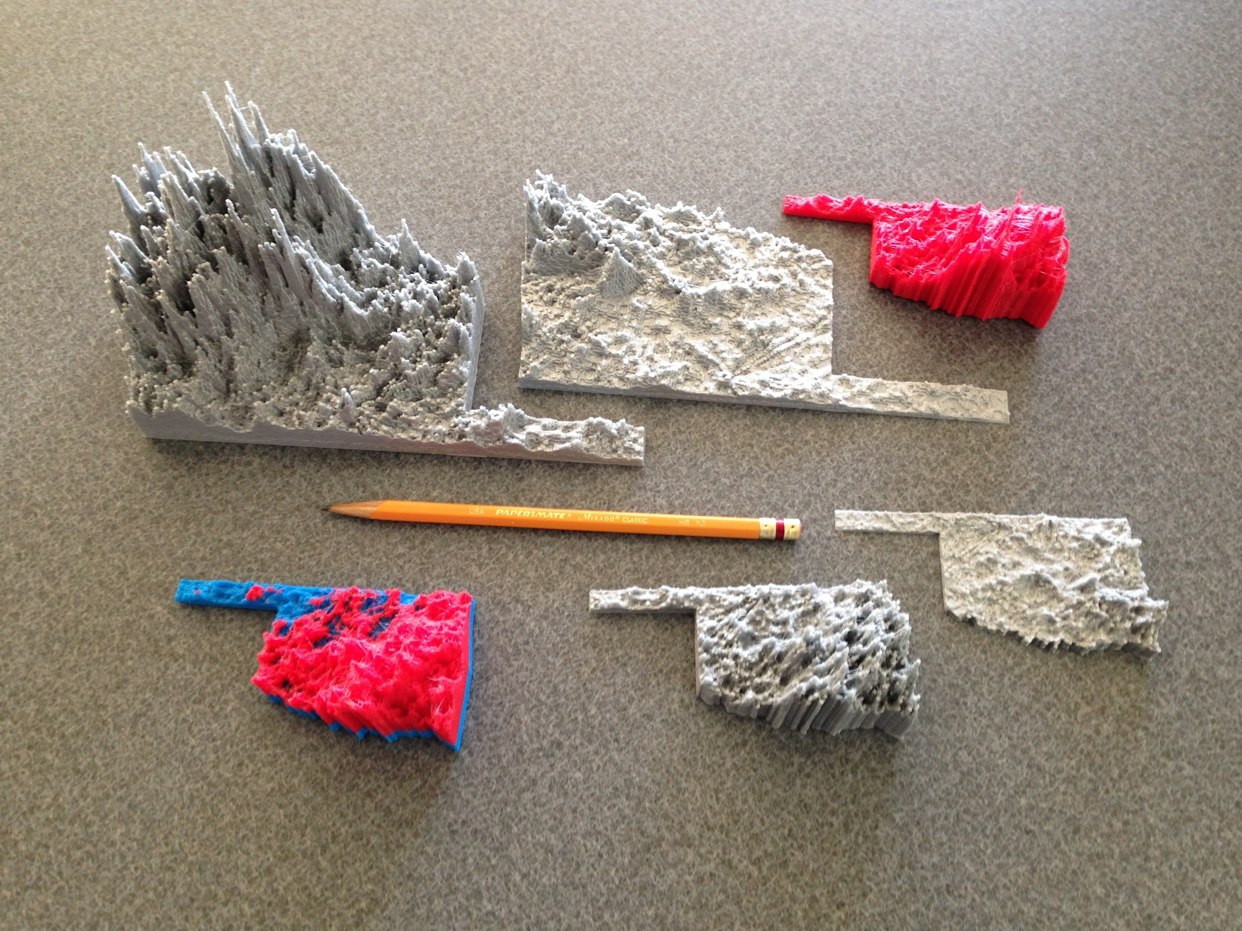
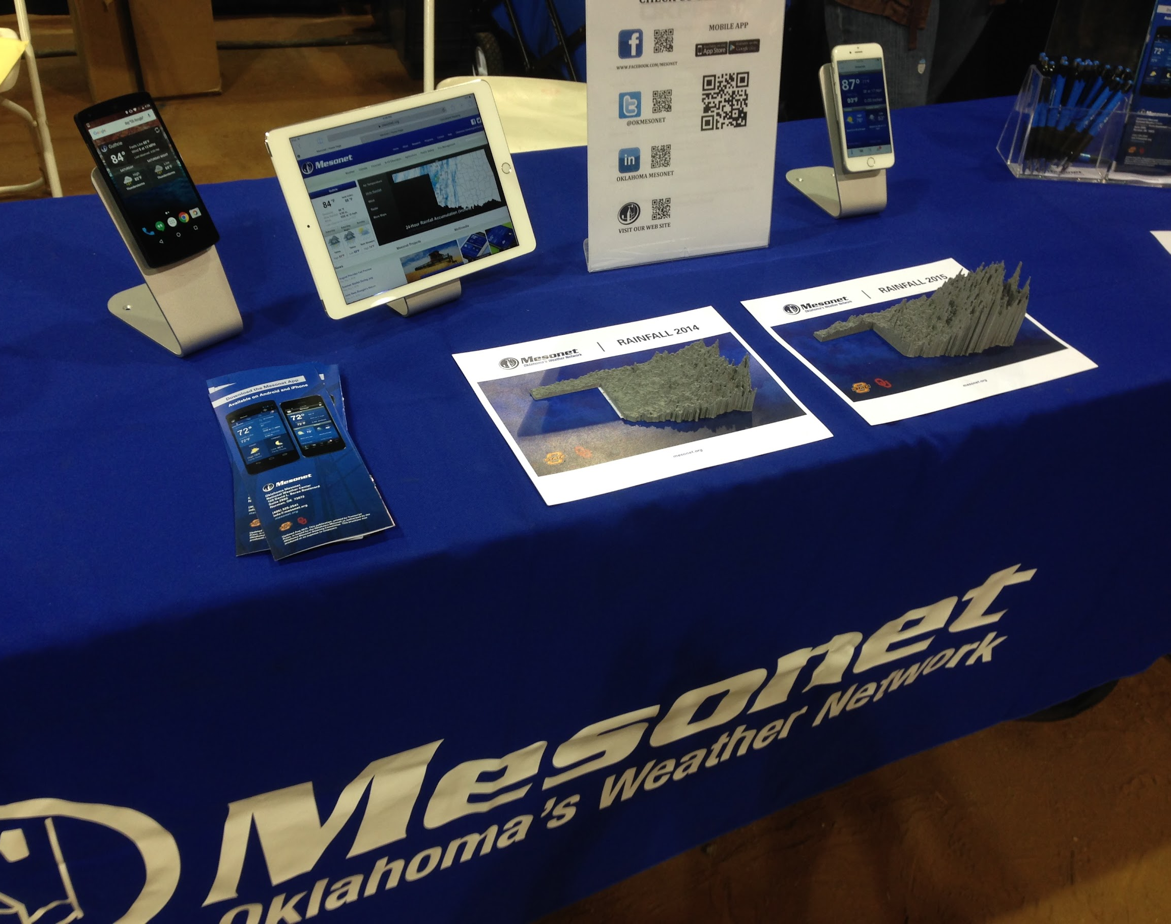
Physical 3D models of rainfall estimates in the state of Oklahoma for the years of 2014 (drought year)
and 2015 (flood year). This tactile data visualization was completed in January 2016 for hands on outreach and accessible science exhibits.
Rainfall estimates were collected from NOAA as hour intervals and were accumulated for the full year
(2014 & 2015) for rainfall year totals represented by height in a map outline of Oklahoma. Multiple
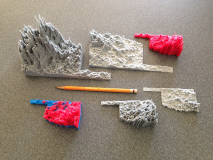
3D models were printed including dual colors to show below average (blue) and above average (red).
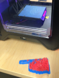
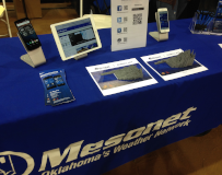
The final product was for use at multiple events throughout the years. This allowed the public to see
visual differences of a drought year (2014) and a flood year (2015) and to hold the 3D models.
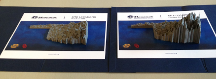
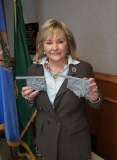
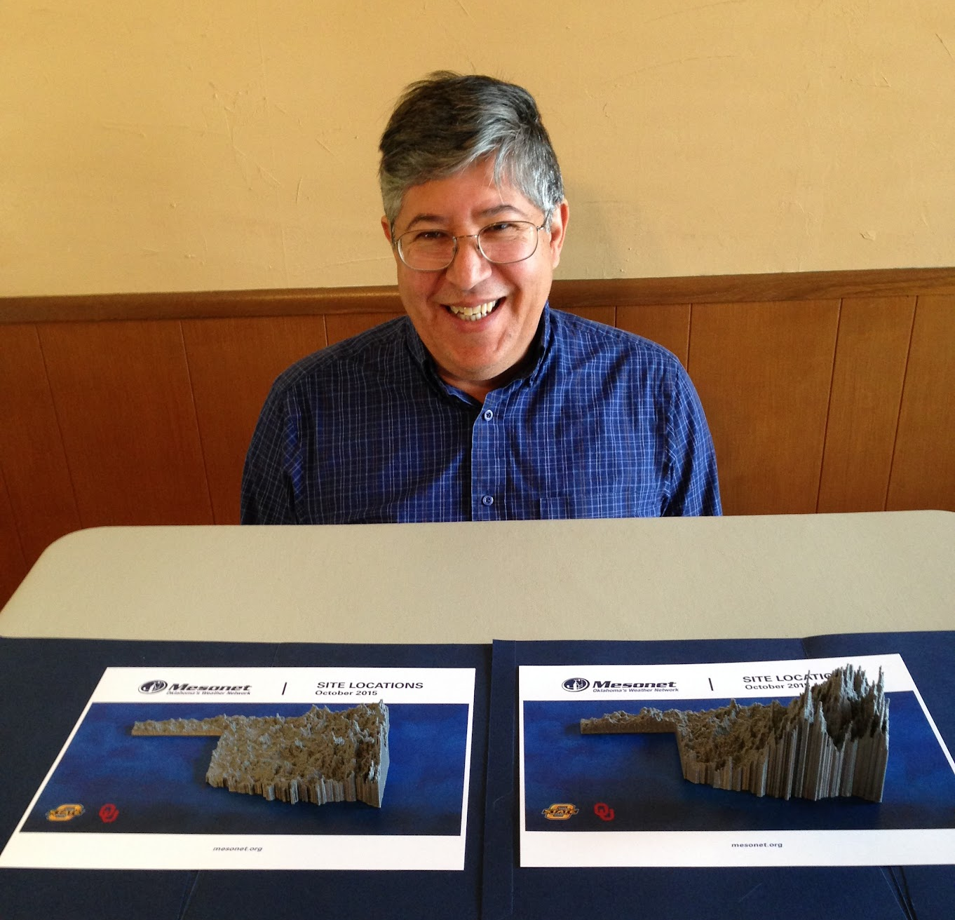
Images above are of side by side 3D prints of rainfall Oklahoma maps (2014 & 2015) and
the Governor of Oklahoma Mary Fallin holding 3D models. The concept, design, and production
of the physical 3D models for outreach were produced by Reuben Reyes for the Oklahoma Mesonet,
Oklahoma Climatological Survey, The State of Oklahoma, and Oklahoma State University.
This project was also the incubator for producing
rainfall 4D models (temporal) in Oklahoma.
Virtual-Reality Demonstrations of “Potpourri of 3D Earth” for GeoForce
This outreach presentation included a wide variety of research geological projects from the Bureau of Economic Geology. The outreach presentations were for Junior High and High School students that were taking a break from geology field tours. The presentations were all in 3D stereo and were interactive. Allowing the students to ask questions about specifics of visualizations and allowing the presenters to zoom in if necessary to explore more detail about the geology. Reuben Reyes was the Project Manager, scripted the visualization of 3D models, and was an active researcher on many of the datasets presented.
This presentation was held for GeoForce in Uvalde Texas, Southwest Texas Junior College on the following dates :
July 6, 2010 , June 23, 2012 , and June 10, 2013
The same presentation was also presented for
Explore UT at The University of Texas at Austin on:
March 6, 2010 , March 5, 2011 , March 3, 2012 , March 1, 2014
Pictured below are two LiDAR datasets presented at GeoForce.


Technical details for this presentation:
Portable two channel video display.
Dual projectors for passive 3D each at 1280x1024 60 Hz.
30 minute active speaker presentation and interactive display.
Drop Inside The Edwards Aquifer
The outreach project
"Drop Inside The Edwards Aquifer" was a highly regarded 7.5-minute computer animation created by the Edwards Aquifer Authority.
It visualizes the intricate, hidden underground world of one of Texas' most vital water sources, exploring the journey of rainwater, underwater cave networks, and the subterranean species that live there.
This animation was displayed at the
Meadows Center for Water and the Environment at Texas State University for public viewing in 2010.
This animation was produced by Patrick McMillan. Dr. Susan D. Hovorka and Reuben Reyes from the Bureau of Economic Geology were consultants and provided computer frame rendering of many of the 3D models using 3D studio Max.

Technical details for this outreach animation were:
Single video channel display DVD at 720x576, Audio: 16 bits per channel
Produced by Toxey / McMillan Design Associates for the Edwards Aquifer Authority in 2009/2010
LCD screen showing
Drop Inside The Edwards Aquifer, a 7 and a half minute animation.
Devil's Sinkhole Interactive VR Display
This outreach project produced a 3D model of the Devil's Sinkhole by converting a massive point cloud to a surface. For this a detailed 3D (3- to 4-cm point spacing) laser map of features inside the sinkhole was rendered into a series of images of the surfaces of the sinkhole that could then be used interactively to view the inside of the sinkhole. The purpose of this multifaceted study includes public outreach for the Devil's Sinkhole Natural Area, and it offers quantitative data for geological and biological studies of karst and karst-hosted aquifers, as well as cave research. The data collected provide insight into the relative timing of the formation of the sinkhole and may provide additional analog data for modeling of subsurface paleokarst systems. Because access to the inside of the sinkhole is restricted, the lidar model allows visitors to experience Devil's Sinkhole from the inside out and to take virtual tours from a bat's eye view. Lidar scanning, mapping and research of this data set was by Dr. Jerome A. Bellian. Conversion from LiDAR point cloud to surface and rendering into VR for use on Apple and Windows computers was done by Reuben Reyes. Two computers, one Apple and one Windows in the visitors center allow the public to take virtual tours inside the Devil's Sinkhole. The outreach part of this project was sponsored by
TPWD and
Devil's Sinkhole Visitors Center in Rocksprings Texas. The installation of the Devil's Sinkhole VR Display was on August 16, 2008. Reuben Reyes was design coordinator, programmer, 3D rendering, conversion to QT VR movie, and installed the VR computers in the visitors center.

Technical details for this outreach project were:
Four video channel display.
Three mirrored monitors on Apple Mac and a single head on Windows PC all at 60 Hz at 5:4 aspect ratio
Both computers used interactive virtual reality.
World of Water Exhibit at the Witte Museum (San Antonio)
The Witte Museum, science and history museum in San Antonio, provided an arena and raised funding for the Bureau of Economic Geology to prepare a STEM outreach visualization of flow processes in the Edwards aquifer as part of the Witte’s 2005 special exhibit focusing on the Edwards aquifer “World of Water”. The visualization became part of the permanent exhibit in 2006 to 2014. Museum staff, working with a community advisory board, requested a virtual field trip through the aquifer following rainfall in the recharge zone through flow paths within the aquifer to discharge at San Marcos Springs. In the Museum, the visualization is presented in a “cave” environment, which is a curved 3-screen, 3-projector system that surrounds the viewer and occupies one’s peripheral vision to provide an “immersive” viewpoint, as if the viewer is experiencing the trip themselves. Dr. Susan Hovorka spearheaded and supervised the project, with funding from Witte Museum in San Antonio and includes the results of many Edwards’ researchers. Reuben Reyes was Director, Associate Producer, responsible for 3D rendering, and 3D Visualization in this outreach project.
Showing of this outreach presentation
World of Water animation was also presented for
Explore UT at The University of Texas at Austin
on March 4, 2006 and March 3, 2007

Technical details for this animation were:
Three video channel display total 3072x768 at 60 Hz (mono) 4:1 aspect ratio.
Audio: Stereo 16 bits per channel.
Animation length 6.5 minutes.
Immersive 3D Virtual Reality
This outreach project was held in fourth-floor of Biodiversity Discovery Hall in the
Texas Memorial Museum at the University of Texas. It features a cutting-edge visualization facility showcasing 3D images of fossils scanned in UT's state-of-the-art CT lab and a wide variety of other natural history presentations. The opening date was January 24, 2004 and was in use for several years. More about this event when it opened can be found here "
Immersive 3-D virtual reality museum exhibit". Reuben Reyes was a consultant and was responsible for visualization of all the 3D models including the 3D skull of a hummingbird below.

Technical details for this outreach project were:
Two video channel display each at 1280x1024 60 Hz
Passive stereo with polarizing filters, 5:4 aspect ratio.
Audio: stereo 16 bit per channel.
Real time rendering of 3D models in loop for about 5 minutes in 3D stereo.
UT Science Showcase
The Texas Advanced Computing Center (TACC) "Science Showcase" refers to the highly acclaimed, interactive 3D simulations and cinematic visualizations produced by TACC's Visualization Services team in the ACES Visualization Lab for the University of Texas and for public outreach.
These animations transform complex supercomputer data into stunning, high-definition videos used to educate the public and further scientific research.
The very first "Science Showcase" was shown publicly on November 10, 2003 in the ACES Visualization Lab.
Reuben Reyes, manager of the ACES Visualization Lab, provided visualization content, content scripting, programmer, and was an active researcher for many of the items in the showcase.
Below is a screen with data from Macquarie Ridge Complex, research initiated by Dr. Laurie Schuur Duncan and then by Dr. Tip Meckel, both worked with Reuben Reyes for 3D visualization on this data set.

Technical details for this outreach presentation were:
Three video channel display total 2816x768 at 96 Hz 3.66:1 aspect ratio.
Audio: stereo 16 bit per channel.
Animation at 24 frames per second for about 6 minutes (mono).
Virtual Tour of Texas
Historical and ongoing exhibits such as the Virtual Tour of Texas were developed in the ACES Visualization Lab to showcase immersive 3D, interactive geological, and geographical environments for Outreach.
This example below was a presentation for the UT Board of Regents on September 7, 2001 that was later used for student and public outreach.
Reuben Reyes' role in this project was he orchestrated the event as Lab Manager, was Project Manager, Programmer, and provided research content.

Technical details for this outreach presentation were:
Three video channel display total 2816x768 at 96 Hz.
3D active stereo 3.66:1 aspect ratio.
Audio: stereo 16 bit per channel.
Real time rendering of 3D models in loop for about 5 and a half minutes in 3D active stereo.
Splash! Into the Edwards Aquifer
Part of this outreach project was a 3D rendered animation "Carved in Stone". This 4-minute computer-animated video featured at the Barton Springs Edwards Aquifer Conservation District's SPLASH Exhibit inside the Beverly S. Sheffield Education Center, Austin, Texas.
The short film details the fascinating geologic processes that created the Edwards Aquifer, illustrating how water travels underground and how the Central Texas landscape looked millions of years ago.
This film was produced by Patrick McMillan.
The majority of the 3D frame rendering was made with 3D Studio Max at the Learning Resource Center in the Aerospace Engineering Building at the University of Texas at Austin.
On this project Reuben Reyes was a consultant and produced the 3D renderings using parallel processing.

Technical details for this animation were:
Single video channel display at 768x512 that ran in a loop.
Audio: 16 bits per channel
Splash! Into the Edwards Aquifer exhibit October 17, 1998
Projector showing "Carved in Stone", a 4 and a half minute computer animation of early earth