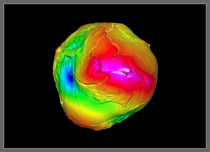
To help better understand the environment and the changing earth the
Center for Space Research put up two satellites under
the
GRACE project. The
satellites measured very small differences in the earth’s gravity. CSR
wanted to view the changes in 3D across the whole of the earth. I
was asked to produce a 3D model for CSR using the GRACE data. At the time I had a very bright
undergraduate Dossym Nurmukhanov working for me. I decided to have Dossym
help me with the 3D model. We took raw data from CSR and outlined how we
would make a 3D model of the earth. We decided to use a color map most
commonly used by
USGS for gravity data. We
also decided to take the very
small differences in gravity and to massively exaggerate them across the
whole of the earth. This was done so that the gravity could be easily seen and
understood. The result was a lumpy earth. In addition we
setup a program to easily add more detailed data as the GRACE satellites
dumped more gravity over time.
More links about this resarch are below.
Featured Wide screen 3D rendering for Science Showcase at UT November 2003
Displayed at SC2004
3D model made avalable on the web 2004