Geological and hydrological visualization models for Digital Earth representation
Reuben Reyes and Dr. Jad R. Ziolkowska
The University of Oklahoma
This page provides supplemental information for this paper:
Geological and Hydrological visualization models for digital earth representation
Two links are of movies made with Google Earth from
Geothermal data and Texas water wells. The Other
four links are to KMZ files for use in Google Earth.
(Four new links were added at the bottom of this page for viewing in Cesium.)
(1) Click here for link to Geothermal movie (mp4 format).
(2) Click here for link to Texas Water Well movie (mp4 format).
The below KMZ files are for viewing and learning purposes.
The map and data in KMZ files if used should reference the paper at top of this page (1st link).
The code and example structures in the KMZ files are free to use but only after publication date.
All data sets (KMZ files) are large and may take time to load
and view. Please be patient.
Subsurface geothermal view below Dallas, Texas looking south.
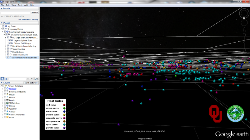
(3) Link to KMZ Texas Geothermal (SubSurface)
(YouTube video of subsurface geothermal KML/KMZ model)
Subsurface visualization of earthquakes below Japan.
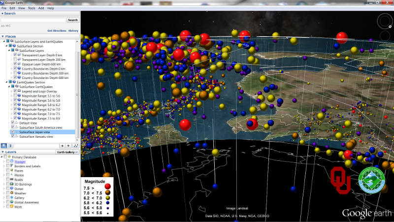
(4) Link to KMZ Earhquakes (SubSurface)
(YouTube video of global subsurface earthquakes KML/KMZ model)
West Texas water wells.
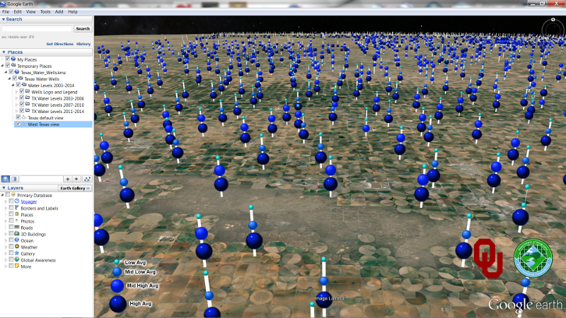
(5) Link to KMZ Texas Water Well (Above Surface)
(YouTube video of Texas groundwater wells KML/KMZ model)
Above surface visualization representation of earthquakes along South America coast.
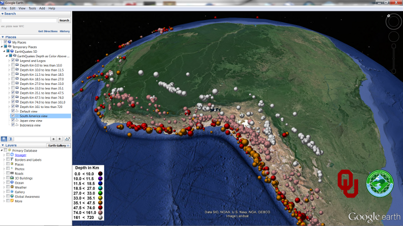
(6) Click here for link to KMZ Earthquakes (Above Surface)
CESIUM SECTION
Four links to Cesium (Texas Geothermal SubSurface, Above Surface Earthquakes,
Texas Water Wells Above Surface, and Subsurface Earthquakes).
For ths best results and view we recommend using Chrome.
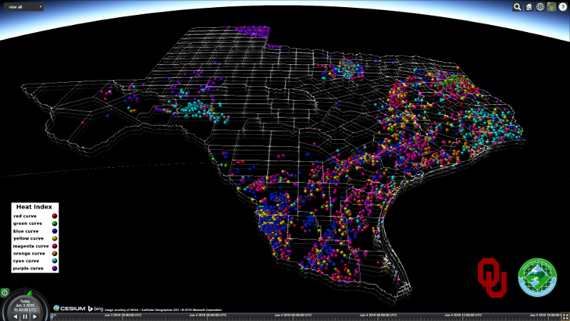
Link to view Texas geothermal heat indexes (below surface) in Cesium.
(YouTube video of Subsurface Geothermal Heat Indexes across Texas)
Cesium Showcase Texas Geothermal Subsurface Visualization
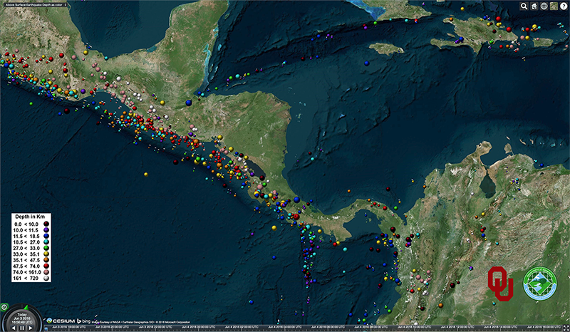
Link to Earthquakes (Above Surface) in Cesium.
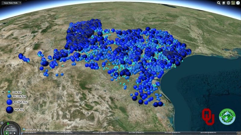
Link to Texas Water Wells (Above Surface) in Cesium.
(YouTube video of Texas Groundwater Well Levels)
Cesium Showcase Texas Groundwater Well Levels Visualization
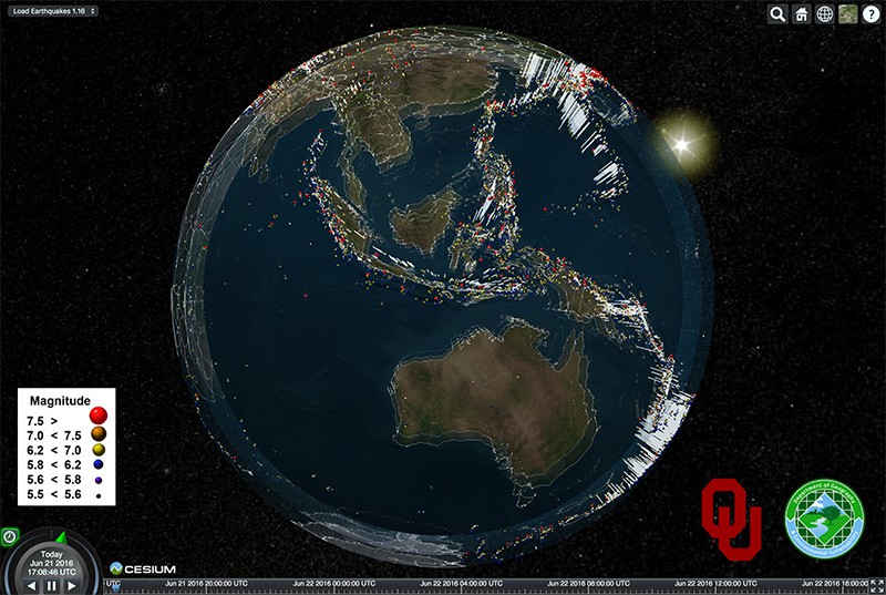
Link to Subsurface Earthquakes in Cesium.
YouTube video of global subsurface earthquakes in Cesium
Cesium Showcase Global Subsurface Earthquakes
The data sets and videos on this page are supplemental information for this paper:
Geological and Hydrological visualization models for digital earth representation
Research by Reuben Reyes and Dr. Jad R. Ziolkowska