Oklahoma Tornado Count by County from 1950 to 2017
Three data sets provided (count, area index, and wind index)
This page provides supplemental information for this AMS 2018 talk:
3D Modeling for Visual Analyses of Recent and Historical Weather and Water Patterns
The datasets assoiated with this talk is a KMZ file.
Click here download Oklahoma_Tornadoes_1950_2017_OCS_Logo.kmz
This file has been tested with
Google Earth, NASA WorldWind, ArcGIS Explorer, and ArcGIS Earth.
You will need Google Earth or some other virtual globe to view the KMZ file.
We recommend using Google Earth if you dont have it installed here is a link:
Click here for link to Google Earth for download and installation.
Click here to view interactive 3D Oklahoma Tornado by County (using CesiumJS).
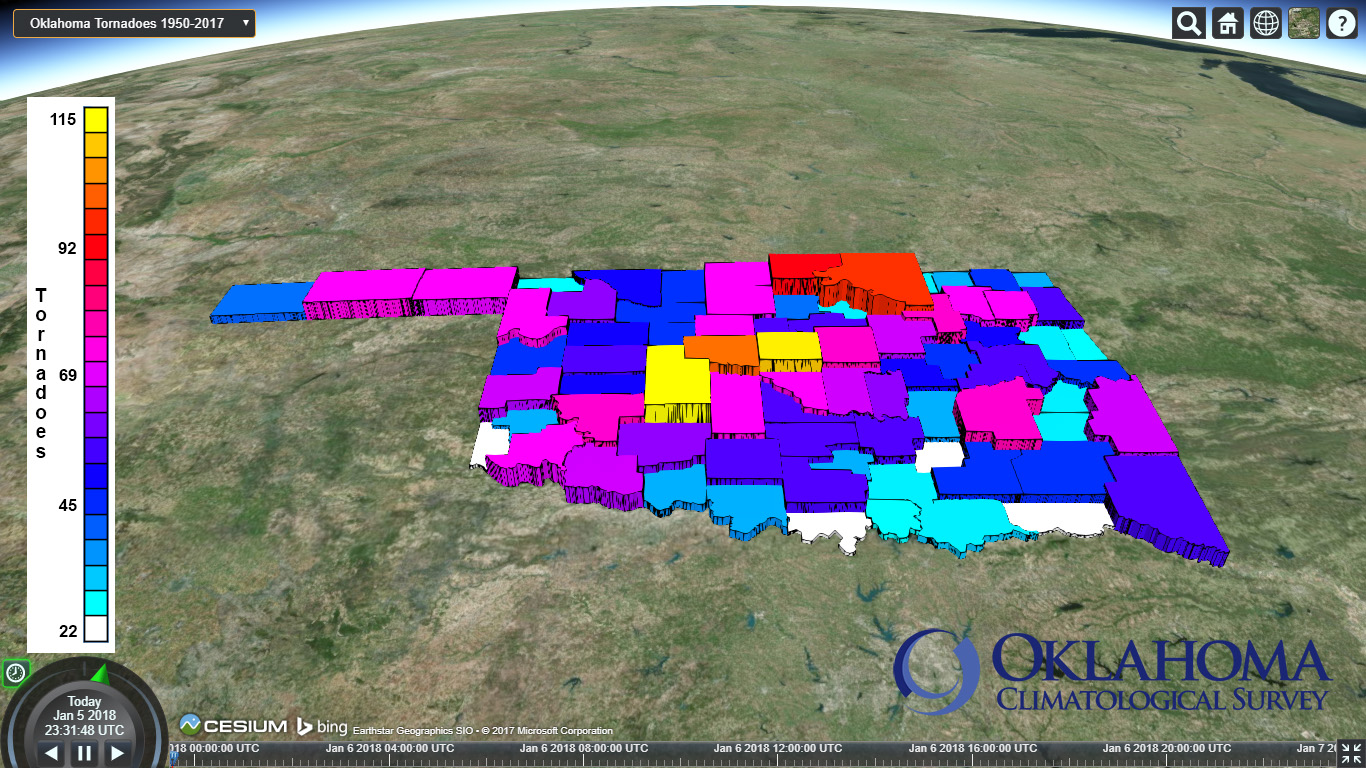
Screen save of Oklahoma Tornado Totals by County using CesiumJS.
More about this image can be found here at Cesium Showcase
Or YouTube Video.
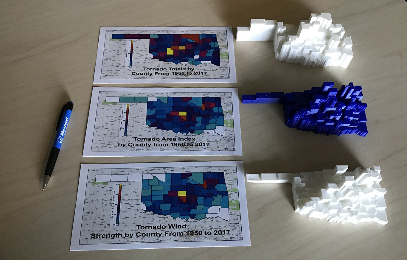
Links below of 3D print files of Oklahoma Tornadoes by County from 1950 to 2017.
Download of 3D print file of Oklahoma Tornadoes by County from 1950 to 2017 in STL : STL file County
Download of 3D print file of Oklahoma Tornadoes Area Index from 1950 to 2017 in STL : STL file Area Index
Download of 3D print file of Oklahoma Tornadoes Wind Index from 1950 to 2017 in STL : STL file Wind Index